FEMA Deleted Texas Camp's Buildings from Flood Map—Report
Brendan Cole
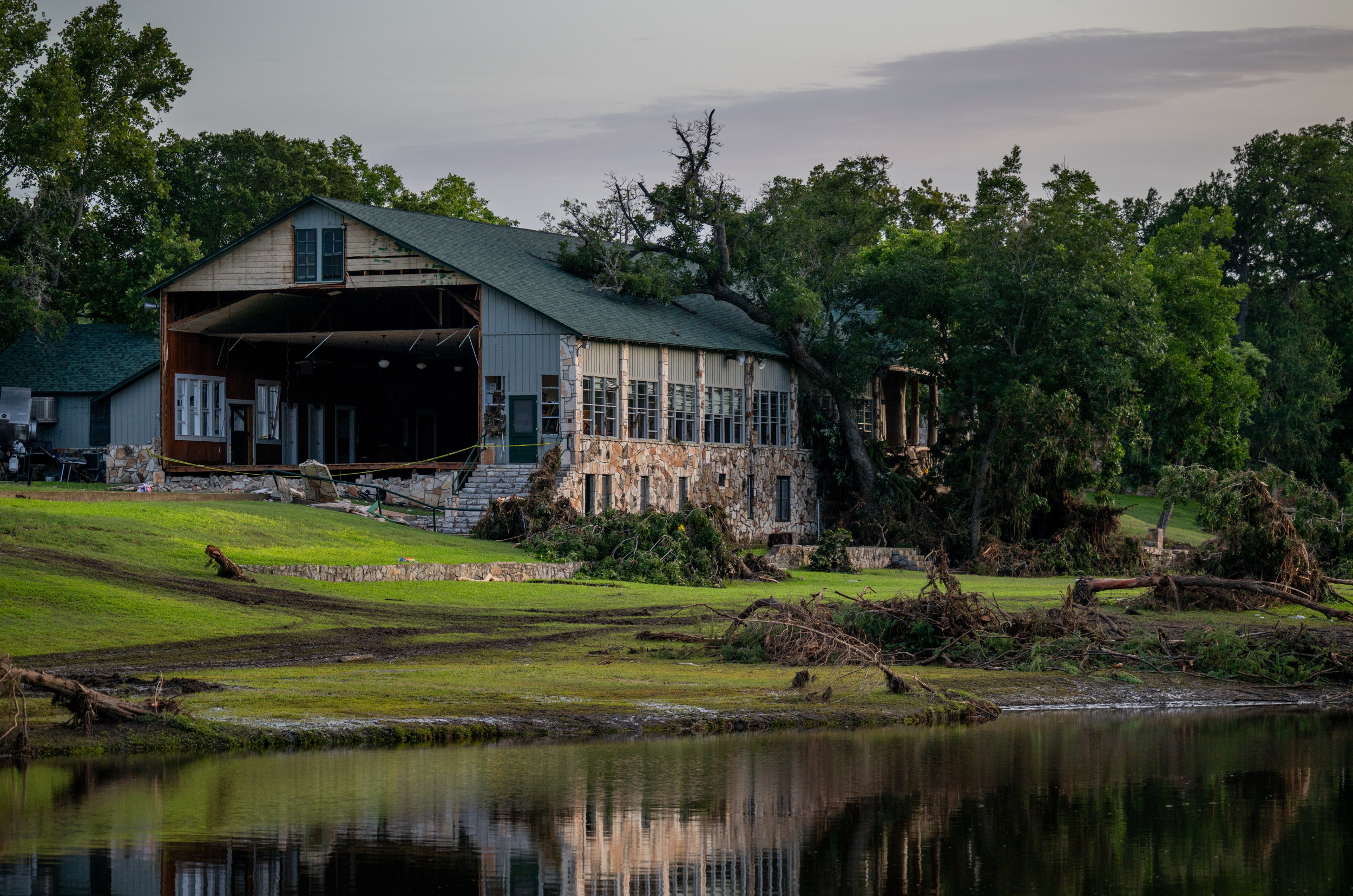
Federal regulators approved appeals to remove buildings from the 100-year flood hazard map of
Camp Mystic, reducing regulatory oversight in a
high-risk floodplain in Texas before torrential waters struck the site, the Associated Press has reported.
In 2011, the Christian girls' camp on the banks of the Guadalupe River, had been included in a "Special Flood Hazard Area" in a Federal Emergency Management Agency (
FEMA) flood map which included requiring flood insurance and stricter construction regulations.
But following appeals, FEMA changed the flood maps in 2013, 2019, and 2020 to exclude 30 buildings across the sites which were part of the camp hit by the flood that killed at 27 people including campers, counsellors and the camp owner, the AP reported.
FEMA told the AP that the flood maps were only snapshots that showed minimum standards for floodplain management and were not predictions of where it will flood.
Newsweek has contacted FEMA and Camp Mystic for comment by email.
Caution tape covers the entrance of Camp Mystic on July 07, 2025 in Hunt, Texas. Brandon Bell/Getty Images
Why It Matters
More than 130 people across mutiple counties have been confirmed dead in the flash floods that hit Texas on July 4 while Camp Mystic has confirmed that at least 27 girls and counsellors were among them.
The AP report raises questions over why a camp responsible for children's safety received exemptions from ....
There are questions over why oversight was eased at Mystic Camp as it expanded in a hazardous floodplain, the AP reported.

www.newsweek.com